Canada Creek Forestry Project
Helping a Michigan hunting and fishing club put ecological health ahead of timber revenue.
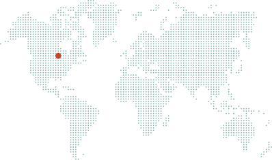
The Canada Creek Forestry Project is an Improved Forest Management (IFM) initiative spanning 11,474 acres of oak, pine, and aspen forest with conifer bogs and northern hardwoods in Montmorency County, in the northeastern portion of Michigan’s Lower Peninsula. The land is owned by the Canada Creek Ranch Association (CCR), a club with a strong hunting and fishing heritage that had previously relied on commercial timber harvesting revenue to support its property’s management and stewardship.
With carbon revenue, CCR avoided alternatives such as member assessments, increased harvesting outside the scope of its forest management plan, and staffing reductions, and has committed that revenue to stewardship, habitat, and long-term project monitoring. The project is registered with the American Carbon Registry and is anticipated to create more than 401,000 mtCO2 of emissions reductions over its first 20 years.
Beyond carbon impact, the carbon project has enabled CCR to hire two additional staff dedicated to ecological work, and Canada Creek, which runs through the project area, is one of approximately ten streams where the federally endangered Hungerford’s crawling water beetle is found.
Additionality
The Canada Creek forest carbon project consists of 11,474 acres of oak, pine, and aspen forest with conifer bogs and northern hardwoods. It is in Montmorency County, in the northeastern portion of Michigan’s Lower Peninsula. The land enrolled in this forest carbon project is owned by the Canada Creek Ranch Association and had been previously managed under a forest management plan that utilized revenue from commercial timber harvesting to support its property’s management and stewardship. Canada Creek Ranch Association (CCR) is a club with a strong hunting and fishing heritage with a mission to provide a quality outdoor environment for their recreational activities.
CCR began exploring alternative ways to fund their stewardship goals and habitat improvements. Initial options included association member assessments, additional allocation fees, increased forest harvesting outside the scope of the forest management plan, and staffing reductions. With the commitment to a forest carbon project and resulting revenue from credit sales, CCR avoided these undesirable outcomes for members and the ecosystem of Canada Creek. CCR has enacted by-law restriction on the Club’s carbon revenue to ensure funding remains committed to:
- Timber expenses such as tree planting, equipment, and forest plan updates
- Shoreline and waterway maintenance
- Seeds and equipment for wildlife habitat enhancement and monitoring
- Local employment for a lead forester and a full-time wildlife biologist
- Long-term carbon project monitoring costs
The carbon project allows CCR to put ecological health first and has enabled them to hire two additional staff dedicated to this work. As described by a Canada Creek representative, “Timber harvesting decisions within the project lands will now be dominated by operations for the betterment of local wildlife, as opposed to seeking monetary returns. We can manage our forestland based on principles of ecologically responsible resource stewardship, sound and farsighted financial management, and an overarching goal to provide a healthy habitat for fish and wildlife for the purpose of viewing, hunting, trapping, fishing, and more.”
Baseline Description
The baseline is modeled according to the typical forest management practices across the region. Throughout Michigan’s Lower Peninsula, private forestland is heavily cut, often through clear-cutting and high grading, wherein the largest, most economically valuable trees are removed without considering the future impact to the forest to maximize investment returns. Wood product demand in this region is strong and consistent across species and product types. A wide range of wood products, including hard and softwood sawtimber, hardwood veneer, and mixed pulp are distributed to areal mills. In the absence of the forest carbon project, Canada Creek Ranch could feasibly harvest as much as any private, non-industrial forestland owner in the region. With a well-established road network, there is easy access for harvesting across the property. If financial pressures were to arise, there was strong potential for CCR to increase harvest levels to intentionally create more open space and/or successional habitat that optimizes conditions for hunting.
Regional Harvest Activities
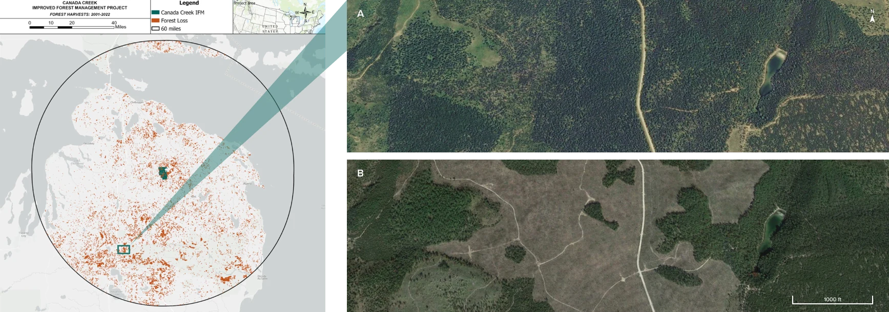
A conservative baseline scenario considers not only what a landowner could do, but what a landowner plausibly would do in the absence of the harvest limitations associated with a carbon project. In the following map, Anew demonstrates actual recent harvests in the project area’s region. This data speaks to the strength of local timber markets and common management practices on forested properties of comparable size and ownership type—an integral piece to inform the accuracy and viability of assumptions in the baseline scenario.
Harvest Comparison
All harvests/forest losses larger than 5 acres that happened between 2001 and 2022 within a 60 mile radius from the project area are depicted in orange, showing the very real pressures on forests in the area. The carbon project ensures sustainable management on the project area for 40 years, twice as long as the period depicted above.
Hansen, M. C et al. “High-Resolution Global Maps of 21st-Century Forest Cover Change.” Science 342 (15 November 2013 & updates): 850–53. https://glad.earthengine.app/view/global-forest-change
Regional Mill Map
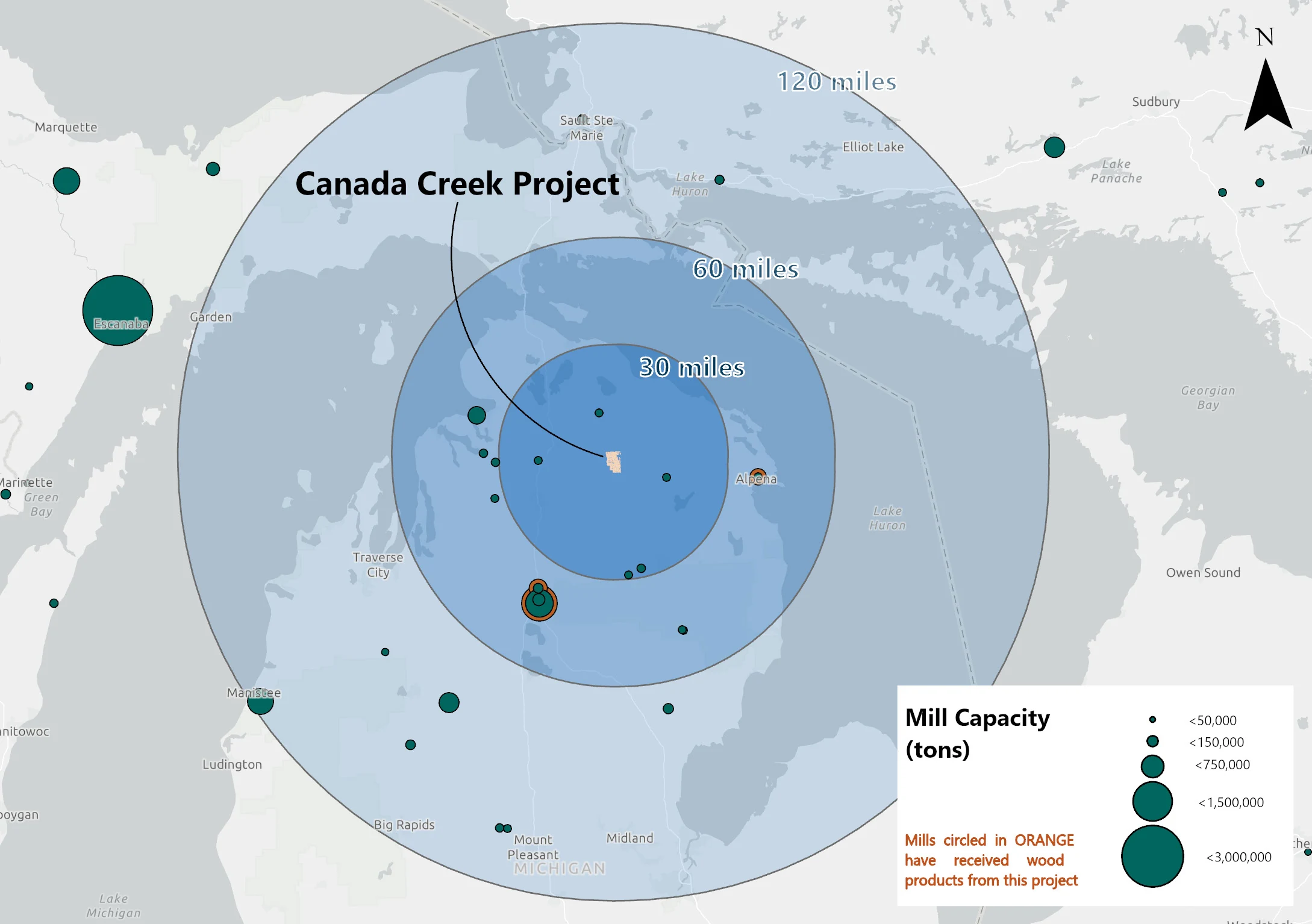
A strong understanding of local forest products infrastructure is key to building a realistic and conservative baseline scenario. To carry out harvests modeled in the baseline, a forest property must be within a feasible travel distance to active processing facilities. This map presents mills that are drivable from the project area along with their relative processing capacity, delineating a framework for a current or future landowner to move timber in the absence of the carbon project, thereby providing a critical piece of direct evidence to the credibility and additionality of the carbon credits resulting from the project’s activities.
Area Regional Mill Capacity
The calculated mill capacity is 3.57 million green tons within 120 miles of the project boundary, and the baseline harvest is 42,796 green tons per year in the first ten years of the project. This equates to 1.20% of the 120-mile mill capacity that is represented by the Canada Creek baseline.
Ecological Highlight
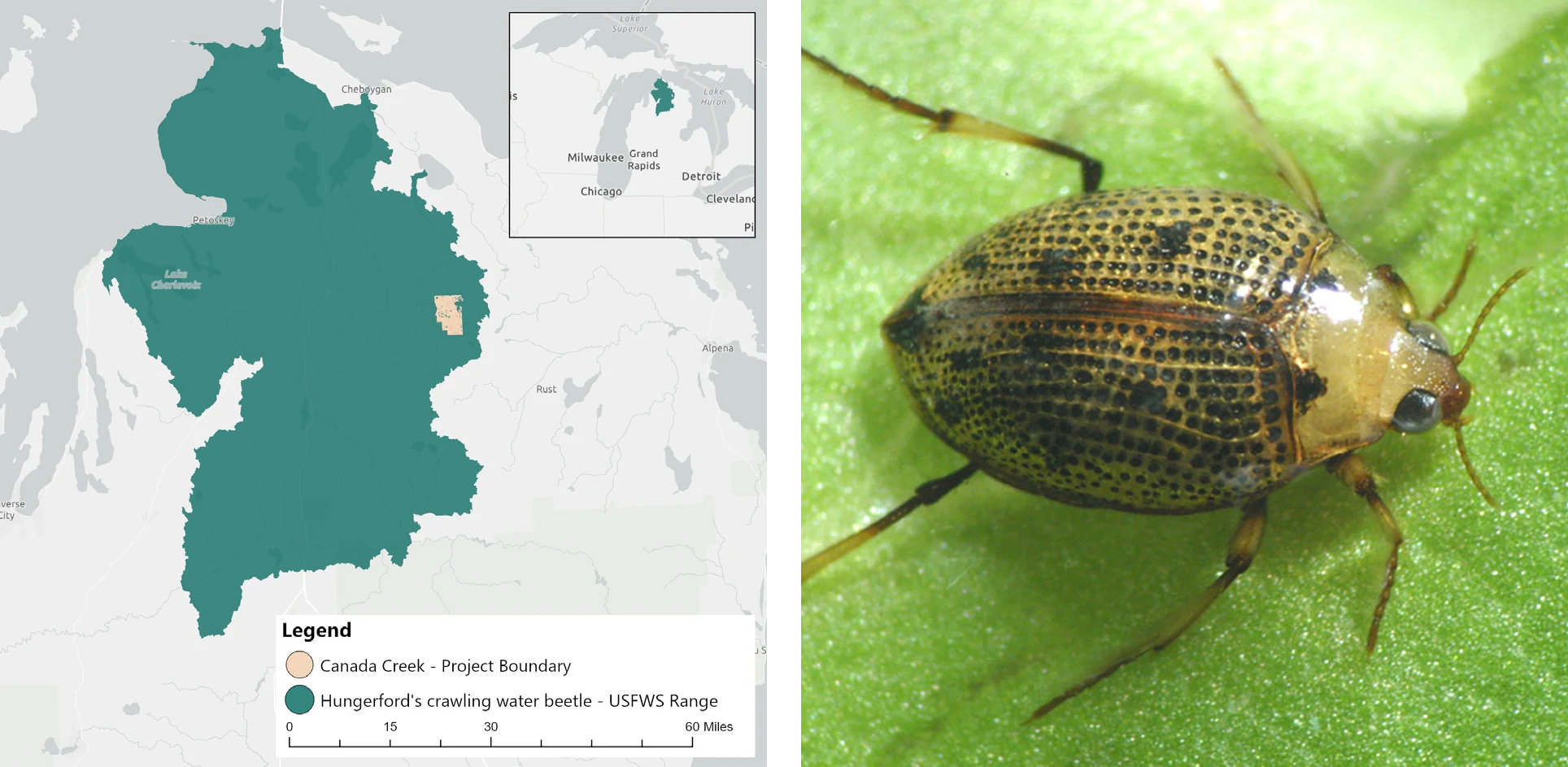
The Canada Creek project lands in lower Michigan overlaps with the limited home range of the Hungerford’s crawling water beetle (Brychius hungerfordi) which represent an important food source for fish and birds and indicate high water quality where they are found. This beetle is federally endangered within the U.S., and is only found in approximately ten cool, fast-running streams in northern Michigan. One of these streams is Canada Creek which runs through the project area. While there is still limited knowledge surrounding the habitat and life cycle of this enigmatic insect, one thing that researchers have agreed upon is that human activities such as logging and general stream degradation contribute to its population reduction due to the stream temperature, alkalinity, and flow requirements of the beetle. The Canada Creek forest carbon project allows the property’s managers to reduce and be more ecologically intentional with their harvesting which can aid the existing beetle population in Canada Creek.
Project Impacts
Sustainable Development Goals in action
A universal blueprint for a better world—Anew is helping deliver on the United Nations global vision for social, economic, and environmental sustainability.

Clean Water and Sanitation
The Canada Creek carbon project contains a portion of Canada Creek, five lakes, marshes, swamps, and other wetlands. The project area includes mixed forestlands and forested bogs unique to the Upper Peninsula of Michigan which are valuable for hydrologic function. The Canada Creek watershed is known for its cold-water temperatures and natural trout population and drains into the Upper Black River. CCR works with the Upper Black River Watershed Council and other experts to implement forest management practices that enhance aquatic resources within the creek. Carbon revenues are reinvested into road maintenance, bridges, and other infrastructure that will reduce sedimentation into freshwater systems across the property.

Climate Action
Management decisions for the forest are focused on natural forest growth, maintenance of forest health, and sustainable harvesting to ensure long-term protection of existing carbon stocks and continued carbon sequestration. Protecting this significant block of contiguous forestland contributes to climate change mitigation and resilience to the impacts of climate change.

Life on Land
The Canada Creek carbon project revenues allow CCR to employ a full-time wildlife biologist to better serve the property’s habitat goals and to design forest operations for the benefit of habitat improvements. Management decisions consider the Kirtland Warbler, located on and near the property, and the northern long-eared bat found on Lost Lake Woods within the property area. The property is also home to the Hungerford Beetle, an endangered species.

How does IFM generate both removals and conservation credits?
Conservation Credits
Conservation credits account for climate benefit coming from the protection of the project area. Emissions that would have been released if the land was instead harvested in the absence of the project are quantified. Many of the co-benefits associated with forestry projects are inherently linked to the preservation of existing forest stands.
Removal Credits
As the newly protected trees grow, carbon is pulled from the atmosphere and sequestered in the trees’ wood material through the most proven direct air capture technology on the planet, photosynthesis.