Doyon Forestry Project
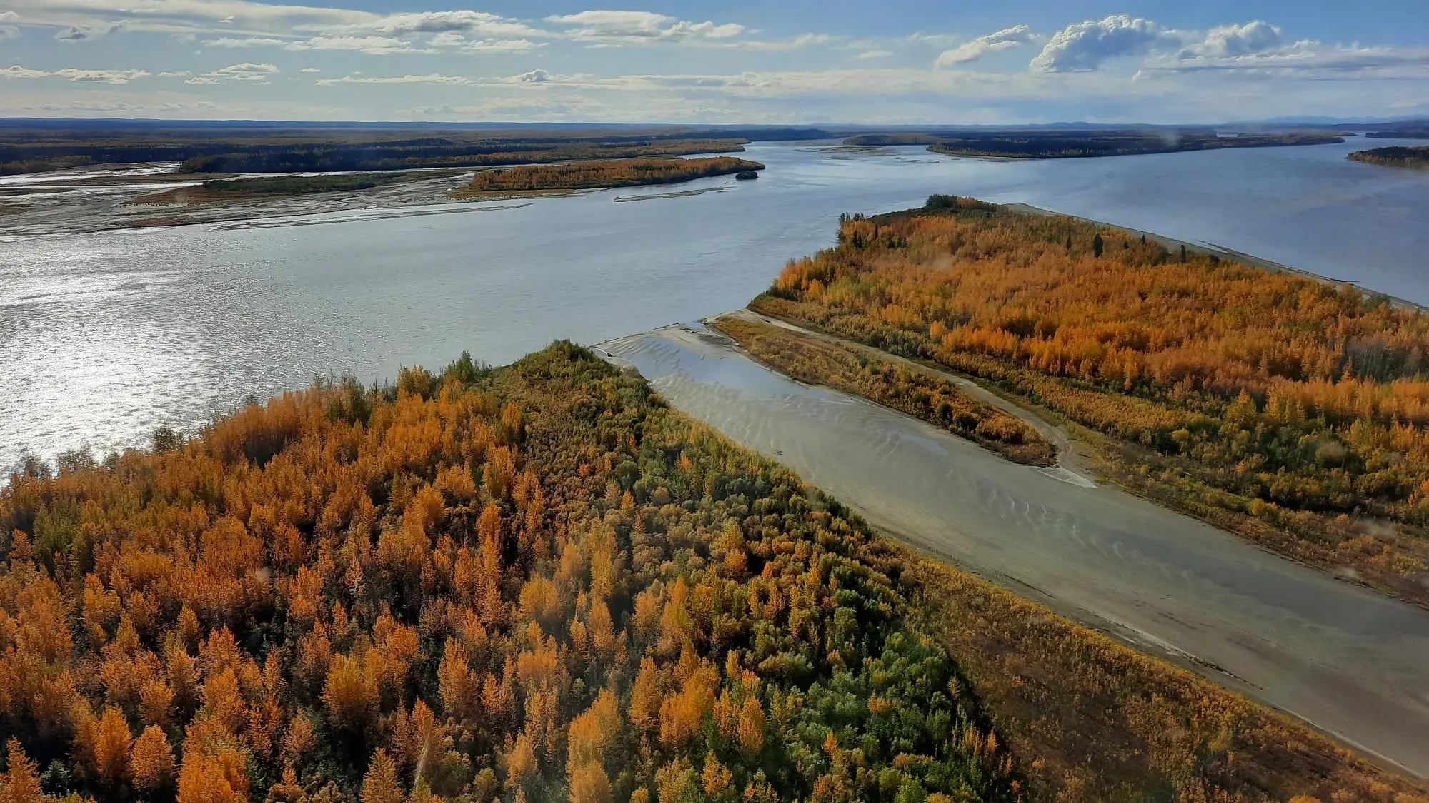
Supporting Alaska Native stewardship of boreal forest by balancing economic opportunity and land preservation.
The Doyon Forestry Project is an Improved Forest Management (IFM) initiative on 172,737 acres of boreal forest across Alaska’s Yukon-Koyukuk and Southeast Fairbanks boroughs. It is part of a much larger land holding of 12.5 million acres received by Doyon, Limited under the terms of the Alaska Native Settlements Act (ANCSA). Historically, forests in the project region have been subject to mineral extraction and timbering activities for fuelwood and building material.
The baseline represents a harvest regime typical of management practices on Alaska Native Corporation lands, with commercial timbering of approximately 1,826 acres per year. Doyon has committed to zero timbering during the forest carbon project’s life, and carbon revenues will fund improved forest maintenance such as protective fire breaks, increased monitoring for natural disasters and insect infestation, and a Forest Stewardship Plan. The project is registered with the American Carbon Registry and is anticipated to create more than 2.6 million tCO2e of emissions reductions over its first 20 years.
Beyond carbon impact, the project lies along the Yukon and Tanana Rivers and their tributaries, which are crucial to local chinook, coho, and chum salmon populations, and its financial success decreases economic pressure on Doyon, Limited to expand mining operations.
Project Summary and Additionality
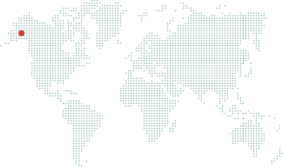
The Anew - Doyon Native Community Forest Project is located on 172,737 acres of boreal forest across Alaska’s Yukon-Koyukuk and Southeast Fairbanks boroughs. It is part of a much larger land holding of 12.5 million acres received by Doyon, Limited under the terms of the Alaska Native Settlements Act (ANCSA). Historically, forests in the project region have been subject to mineral extraction and timbering activities for fuelwood and building material. The entire project area is within 4 miles of existing transportation infrastructure and is located in parcels around the Fairbanks population hub. Fairbanks is the largest city in the region and has mill facilities which supply 11 other local cities and 17 villages with timber products. Carbon revenues will allow Doyon to enhance its environmental stewardship on the project area through improved forest maintenance measures such as cutting protective fire breaks around portions of the property prone to fire, increasing monitoring of the property for natural disasters and insect infestation, and ensuring long-term sustainable management through the development of a Forest Stewardship Plan. The financial success of the carbon project will also serve to decrease economic pressures for Doyon, Limited to expand mining operations.
The following quote from Doyon Limited’s president and CEO emphasizes the impact carbon markets have had on their management outlook:
Profits directly support shareholder’s economic, cultural, and social potential. Our shares cannot be bought or sold, they are a birthright to those with a direct tie to the region. Developing responsibly while manifesting meaningful economic opportunities for our people is imperative. In order to ensure a healthy and sustained growth trajectory for our people, we are looking at partnering with like-minded companies to join in our carbon offset program and put our trees to work. This is an opportunity to balance economic development and land preservation. As part of our inaugural carbon offset project, we are committed to sustainably managing and preserving our land to be sold as carbon offset credits. Our land is the core of our indigenous soul, integration of cultural, social, and economic values and practices will ensure the health and wellbeing of future generations and enhance environmental stewardship.
— President and CEO, Doyon, Limited
Baseline Description
Alternative land management scenario in the absence of the carbon project
The baseline scenario represents a harvest regime typical of management practices on Alaska Native Corporation lands and includes annual acreage restrictions to account for access constraints, mill capacity, and timber demand. Baseline practices involve commercial timbering of approximately 1,826 acres per year. This harvest rate is equivalent to only ~1% of the project area being harvested annually, and less than 0.1% of the total 12.5 million acres under Doyon, Limited ownership. As an additional measure of conservativeness, baseline harvests are restricted to being within two miles of existing roadways and navigable waters for the first project decade and never take place beyond four miles from such infrastructure for the entire project life.
Harvests in the baseline target trees over 9” in diameter (DBH), white spruce stands are cut for sawlogs, and smaller timber species are utilized for fuelwood. Timber supply would support the local mills in Fairbanks, North Pole, and Tok that produce various forest products needed for use in Alaskan communities. Wood products produced in these mills include sawlogs for building material, firewood, pellets, and biomass to feed boilers that generate heat and electricity. All timber harvests are conservatively assumed to be processed and consumed in the region, even though there is precedent for wood product exports.
Regional Harvest Activities
All harvests/forest losses larger than 5 acres that happened between 2001 and 2021 within a 60 mile radius from the project area are depicted in orange, showing the very real pressures on forests in the area. The carbon project ensures sustainable management on the project area for 40 years, twice as long as the period depicted below.
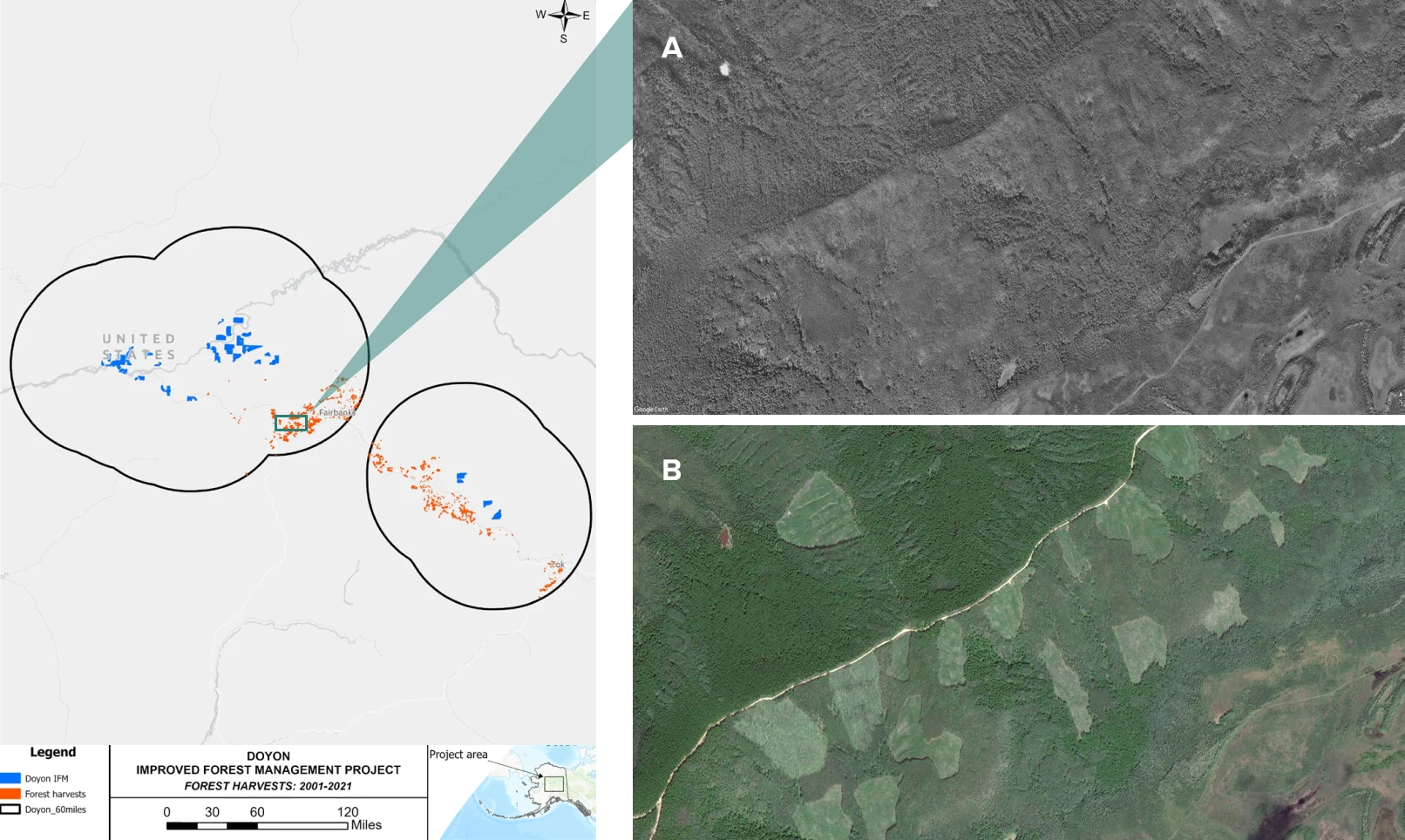
Hansen, M. C., P. V. Potapov, R. Moore, M. Hancher, S. A. Turubanova, A. Tyukavina, D. Thau, S. V. Stehman, S. J. Goetz, T. R. Loveland, A. Kommareddy, A. Egorov, L. Chini, C. O. Justice, and J. R. G. Townshend. “High-Resolution Global Maps of 21st-Century Forest Cover Change.” Science 342 (15 November 2013 & updates): 850–53. Data available on-line from: https://glad.earthengine.app/view/global-forest-change.
Regional Mill Capacity
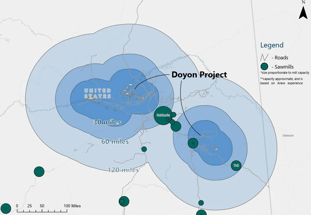
This map represents forest product mills within the vicinity of the Doyon project area. Had harvesting been pursued in the absence of the carbon project, there is ample mill capacity in the region.
Ecological Feature: Salmon Habitat
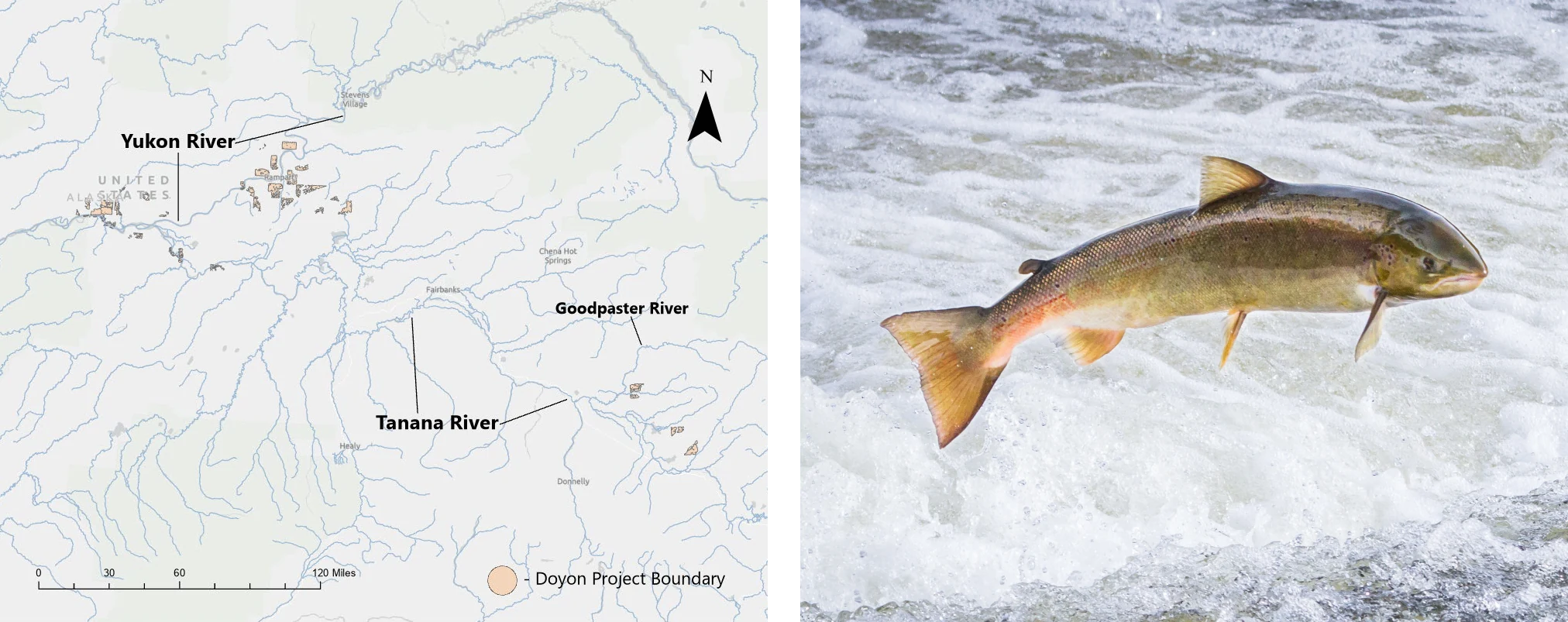
The Doyon project lies along major river systems (Yukon & Tanana Rivers) with significant tributaries (Goodpaster River) that are crucial to the local chinook, coho, and chum salmon populations. These populations are of critical importance to both the Alaskan fishing industry and native communities but have seen unprecedented decline in recent years due to rising water temperatures negatively effecting spawning. Project related efforts to mitigate climate warming will help to prevent temperatures from rising to levels unsuitable for salmon populations, and Doyon’s commitment to zero timbering during the forest carbon project’s life prevents harvest activities from contributing to pollution of aquatic habitats.
Project Impacts
Sustainable Development Goals in action
A universal blueprint for a better world—Anew is helping deliver on the United Nations global vision for social, economic, and environmental sustainability.
Quality Education
The project supports a private foundation with the overall goal of improving quality of life and a focus on educational scholarships and language revitalization.

Clean Water and Sanitation
The protected forest helps to filter and purify the water for all who rely on it from the West Central Yukon and Tanana River watersheds.

Sustainable Cities and Communities
The project has provided a way to help preserve the sustainable land management practices of the native people, balancing economic opportunity and conservation through community investment.

Climate Action
This project will help trees grow into maturity and sequester a greater amount of atmospheric carbon dioxide through their natural life cycles. Over its first 20 years, the project is anticipated to create over 2.6 million tCO2e of emissions reductions.

Life on Land
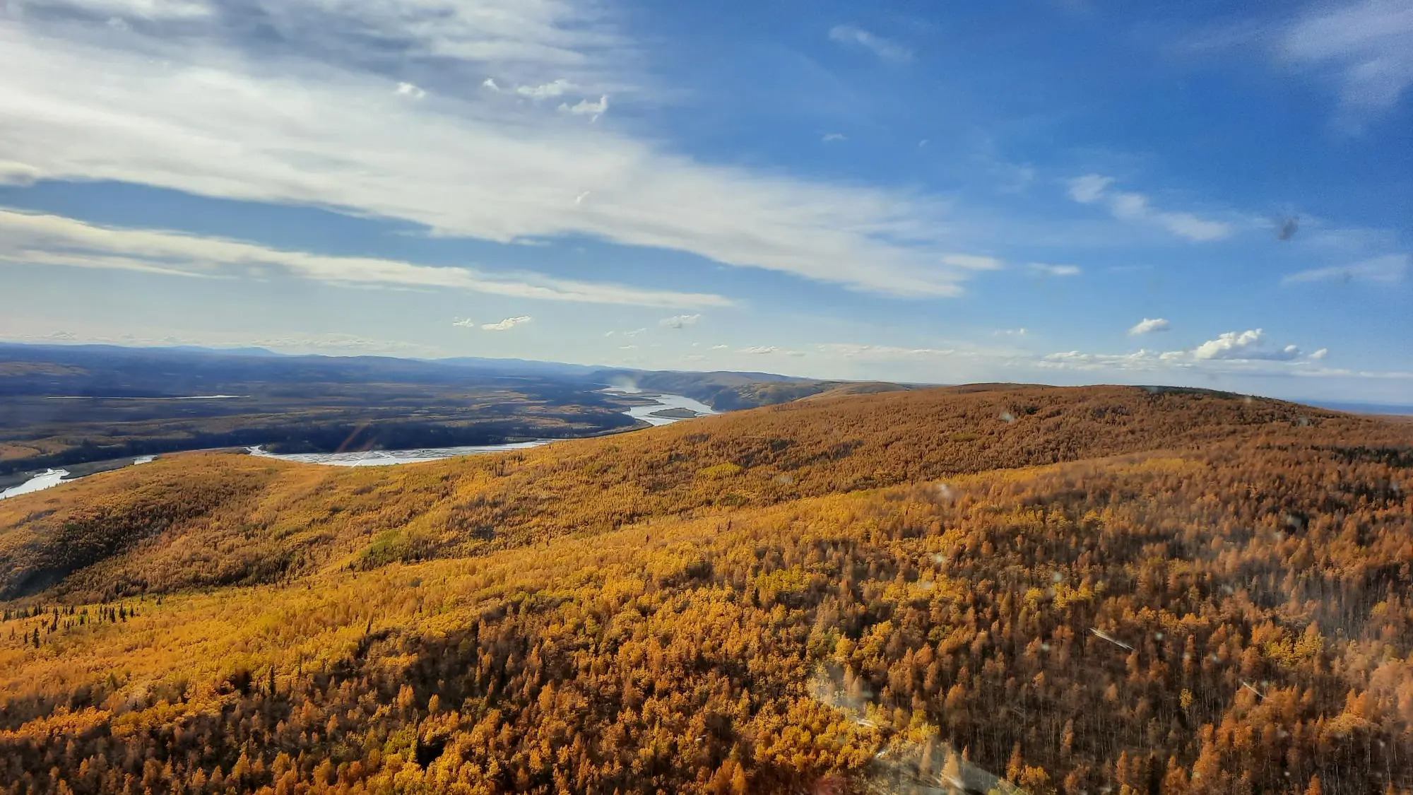
The project is within the habitat range of the Eskimo Curlew, an endangered bird that has not been seen in over 55 years. It also includes a portion of the largest unimpacted boreal forest in the world.
How does IFM generate both removals and conservation credits?
Conservation Credits
Conservation credits account for climate benefit coming from the protection of the project area. Emissions that would have been released if the land was instead harvested in the absence of the project are quantified. Many of the co-benefits associated with forestry projects are inherently linked to the preservation of existing forest stands.
Removal Credits
As the newly protected trees grow, carbon is pulled from the atmosphere and sequestered in the trees’ wood material through the most proven direct air capture technology on the planet, photosynthesis.